A radar signal from space is going to show the state of the forests
 Photo: NASA Public Domain
 Starting in 2024, a new space project will remotely analyze Earth’s forests and soil. The initiative involves NASA and the Indian space agency ISRO
by Matteo Cavallito
Understanding the dynamics of ecosystems, including forests, analyzing the carbon cycle and the effects of human activity. This is the goal of NISAR mission, a joint operation involving NASA and ISRO, the Indian Space Agency. The initiative will be launched in early 2024.
This operation will result in the launch of a satellite that will collect important data through the use of a radar system that “will scan nearly all of Earth’s land and ice surfaces twice every 12 days,” a NASA statement explains. “The data it collects will help researchers understand two key functions of both ecosystem types: the capture and the release of carbon.”
Exploitation of forests generates 11 percent of anthropogenic emissions
Researchers thus hope to track land cover changes on a global scale and their consequences. “The radar technology on NISAR will allow us to get a sweeping perspective of the planet in space and time,” said Paul Rosen, a scientist at NASA’s Jet Propulsion Laboratory in Pasadena, California. “It can give us a really reliable view of exactly how Earth’s land and ice are changing.”
Forestry and other land-use changes, the researchers recall, account for about 11 percent of net human-related greenhouse gas emissions.
The new data will provide a better understanding of how deforestation affects the carbon cycle and contributes to global warming. “Globally, we do not understand well the carbon sources and sinks from terrestrial ecosystems, particularly from forests,” explained Anup Das, co-director of the group of ISRO scientists involved in the project. “So we expect that NISAR will greatly help address that, especially in less dense forests, which are more vulnerable to deforestation and degradation.”
A weather-proof system
The system is based on the use of a radar capable of penetrating leaves and branches by bouncing off tree trunks and the ground below. Subsequent analysis of the reflected signal will make it possible to estimate the density of forest cover, its variation over time, and some clues as to its possible causes.
Radar technology thus makes it possible to overcome the obstacles that forest conformation or weather conditions can sometimes set before researchers.
By studying the signal, in fact, scientists will be able to better understand the dynamics affecting “vast, often cloud-covered rainforests such as those in the Congo and Amazon basins, which lose millions of wooded acres every year.”
NASA and FAO against deforestation
This is not the first time geospatial data have been used to monitor and curb deforestation. In 2021, for example, FAO and the World Resources Institute (WRI) launched a $13.7 million initiative with the support of several partners including Google and NASA.
The project, known as the Forest Data Partnership, also involves Unilever and is based on the use of the NASA-USAID SEVIR program. Its goal, the FAO explained, is to work “towards a consistent geospatial data ecosystem so that all actors – local, government, producers, traders, and financiers – are able to access consistent, open-source, publicly available, and validated geospatial data related to forest-risk commodities and restoration.”
Earthquakes, landslides and floods under the lens
In addition to tracking changes in forest ecosystems, the NISAR satellite will also collect information on ground motion. This will help researchers understand the dynamics of various phenomena such as earthquakes, volcanic eruptions and landslides. As well as melting glaciers and sea ice.
Also under the satellite’s lens are the dynamics at work in wetlands. When wetlands dry out, scientists remind us, the carbon they store is exposed to oxygen, generating the release of CO2.
The researchers also aim to better understand how climate change, the rainfall patterns it affects and human activities together are affecting the extent, frequency and duration of flooding in the wetlands themselves. By monitoring seasonal and annual variations to identify long-term trends.
 pxhere CC0 Public Domain Free for personal and commercial use No attribution required
 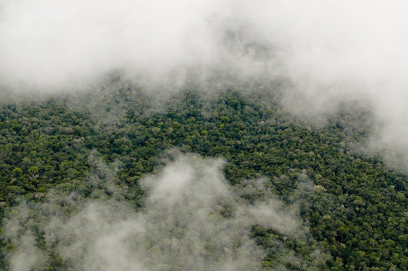 Photo: Neil Palmer/CIAT. Attribution-NonCommercial-NoDerivs 2.0 Generic (CC BY-NC-ND 2.0).
 Photo: Charbel El Khouri - International Center for Biosaline Agriculture, CC BY-SA 4.0

